

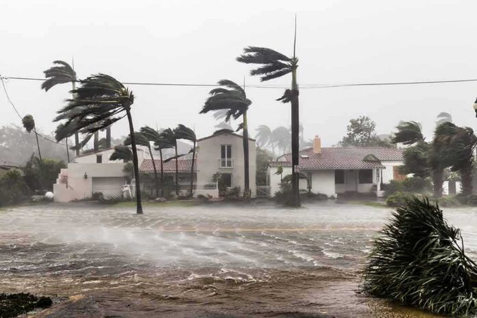
Hurricane Isaias is gaining strength over the Gulf of Mexico, and forecasters say it will keep getting more dangerous before it slams into the northern Gulf Coast.
Story Snapshot
- The National Hurricane Center says Isaias will keep strengthening through early Friday as it closes in on the coast.
- Forecasters warn Isaias should stay a dangerous hurricane right up to landfall Friday night.
- Storm surge, hurricane warnings, and tropical storm warnings now stretch across Louisiana, Mississippi, Alabama, and the Florida Panhandle.
- Officials expect damaging winds, life-threatening surge, and heavy flooding rain along the northern Gulf Coast into the weekend.
Storm Tracks Toward A Dangerous Gulf Coast Landfall
The National Hurricane Center says Isaias is on track to pass north of the Yucatan Peninsula before making landfall along the northern Gulf Coast late Friday or Friday night, inside the current warning zone. Forecasters built this track from satellite data, aircraft readings, and computer models that have stayed in solid agreement on the storm’s general path toward Louisiana, Mississippi, Alabama, and the Florida Panhandle.
Early forecasts already pointed to serious trouble. One advisory flagged top winds near 110 miles per hour, putting Isaias in range of Category 2 strength before it reaches shore. That kind of wind can snap power poles, peel roofs off buildings, and knock out electricity for days across coastal communities that are still rebuilding from past storms.
Why Forecasters Expect The Storm To Keep Growing
The National Hurricane Center says additional strengthening is expected through early Friday, and Isaias should remain a dangerous hurricane as it nears the northern Gulf Coast Friday night. Warm Gulf waters act like fuel for a storm like this, and when wind shear stays low, hurricanes often get stronger right up until they hit land, which is exactly what forecasters are watching now.
The National Weather Service echoed that warning, saying there is an increasing risk of damaging hurricane-force winds and life-threatening storm surge along parts of the northern Gulf Coast from Friday into Saturday. Local forecast offices across the region have been updating residents hour by hour as the storm’s intensity numbers shift upward.
Warnings Now Cover A Wide Stretch Of Coastline
A storm surge warning stretches from the mouth of the Mississippi River to the Steinhatchee River in Florida. A hurricane warning covers the coast from Ocean Springs, Mississippi, to the Bay and Gulf county line in Florida, and a tropical storm warning runs from the Jefferson and Plaquemines Parish line in Louisiana westward. That means millions of coastal residents fall under at least one active warning right now.
Rainfall totals add another layer of danger. Forecasters say the system is expected to produce heavy rain across the central Gulf Coast from Friday through the weekend, raising the risk of flash flooding well inland from the beaches. Low-lying neighborhoods and areas near rivers face the highest flood risk as the rain bands move ashore.
How This Fits The Bigger Picture On Hurricane Forecasting
Hurricane track forecasts from the National Hurricane Center tend to be more consistent and carry lower errors than individual computer models, though they are never an exact pinpoint of where a storm will hit. Isaias fits a familiar pattern: warm water and low wind shear driving intensification, the same two factors researchers point to as the main drivers behind hurricane strength forecasts.
Residents along the warned coastline should treat every advisory update as the latest best estimate, not a locked-in outcome. Hurricane tracks can shift, and intensity can change quickly in the final hours before landfall. The safest move for anyone in the warning zone is to finish storm preparations now, because Isaias is still gaining strength on its way to shore.
Hurricane Isaias is gathering strength Thursday morning despite persistent crosswinds, raising the threat of damaging winds and flooding across a wide stretch of the US Gulf Coast https://t.co/KwKJEoc6hx
— Bloomberg Green (@climate) October 8, 2026
Local officials across Louisiana, Mississippi, Alabama, and the Florida Panhandle have urged residents to secure property, stock emergency supplies, and follow evacuation orders where issued. The storm’s combination of surge, wind, and rain threatens a wide area, and forecasters say conditions will deteriorate fast as Isaias closes the final distance to the coast.
Sources:
washingtontimes.com, nhc.noaa.gov, star.nesdis.noaa.gov
© standardheadlines.com 2026. All rights reserved.